Monday, 21 May 2007

Fox, Horse, Hare.....its all here!

A new day, a new section of the Ridgeway path. My car having been left
in a handy pub car park I climbed, in a slight drizzle at first,
up the slope onto Fox Hill (with the radio mast.
This is a "whence I have come" shot with the Marlborough Downs and the
various clumps of trees on the furthest ridge and Liddington castle just near
to the little tuft of trees in the middle!) .

Once again the pathway was pleasingly edged with thick hedgerow
and this good days walk was one to have plenty of wildlife, and flora.

Campion


Viper's buglose
a plethora of species.


Of bird life, their were lots of whitethroats (above)with their scratchy songs, yellowhammers,
a bullfinch (which is the first one I have seen for some time!), goldfinches, corn buntings, sky larks (of course), meadow pipits, blue and great tits, lapwings and red-legged partridges. There were also buzzards, a kestrel and (rather surprisingly I thought)
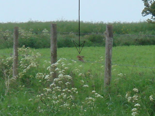
herring gulls (I couldn't help thinking of Keehar in "Watership Down" with his German "Yah!Yah!" in the animated version....heehee!) . As for mammals...well one dear, one (very quick glimpse ) bank vole, and rabbits. Domestically, of course, there were also sheep a-grazing, pigs a-squealing...And then, of course, there was an occasional curious heifer.
This one stopped by to help me located myself on the map. (I was interested in the abrupt occurance of the little dry valley in the background.)


Todays big features, however, were further ancient ones. First of all
I reached Wayland's Smithy, a large long barrow burial site dating back
to ahout 3000bc.


Wayland (oe Weland) the Smith was an Anglo-Saxon god/elf who (they supposed)
would re-shoe your horse for you here overnight, if your left the horse and a coin
here. More information here:

Well, there were no horses to be seen here, So Weland was having a quiet
rest no doubt. I, however, had to be on my way once more.
the next site of interest was approached soon after a throng of school children
and accompanying adults passed me by, on their way to the Smithy, no doubt.
"I timed that well" I thought to myself!
So "Where to next?" you ask
Yes. Another hill fort on the horizon....

White horse??

Yes!!
White horse indeed!
The White horse of Uffington
Oldest and biggest of the lot.


The horse is gracefully sprawling on a (relatively) gentle slope of the scarp face, and tantilisingly impossible to view fully at close range, except from the air.
see this LINK for clearer views and more detail!!


At the foot of the slope is the odd little lump of Dragon Hill


and to the west of it some weird little chalky crinkles, apparently known as


"the manger"


So Fox Hill

White Horse Hill.

so next "Hare Hill"?
No. A live one!


Hare here....


Sunday, 20 May 2007

Go on! From Og....

Ogbourne St. George formed the starting point for today's
walk. I was much relieved to find, on reaching the Ridgeway path,
that today's section had the propect of being much less spartan
in nature.


Green hedges bedecked with may blossom were
much in evidence. The weather too was kinder on me.
Gone was the forceful wind, and the bright sunshine
was moderated by cloud. Gone too was the bright yellow
of oilseed rape flowers. Whew!

From my Ogbourne start point the pathway
heads northwards back along towards the
head of the Og valley, where, lo and behold...

another hill fort, Liddington Castle
"stands guard", again affording
a place for a lunchtime stop. It also allows
for a wide panoramic veiw, whether towards
Marborough, across towards Barbury castle,
beyond the sprall of Swindon to the Cotswold hills,
or even over towards Oxford.
Another feature (like Swindon, worth trying to ignore
for aesthetic reasons, even if its jolly handy
for getting places....!) nearby is the M4 whose
traffic forms a little aural backdrop to the scene
as it clambers over a little lip onto the chalklands


before dashing onwards to the east.
On the plus side, at least the mtorway
is not TOO glaringly obvious, its embedded into
the downs that roll around it....
you may have clouds to spot above.....


and there are always things near at hand, like
poppies splashing red, or corn buntings jangling
their keys in the hedges alongside.


On the far side of the motorway stands Fox Hill, awaiting me tomorrow.

Friday, 18 May 2007

Cloud spotting

I am loving "The Cloudspotters Guide" book by Gavin Pretor-Pinney
and a link to the "Cloud Appreciation Society" website from my blog
is thus a must.

So, done (just click on the title here
....or on the side panel!).

Wednesday, 2 May 2007

Berwick Bassett figure of 8

Today was a bright but breezy day, and time to be
getting on with my Ridgeway project!
So a bit of a drive (....frustratingly finding myself
touching on bits of Swindon on the way, which I had
no desire to do! Grrrrr!) brought me eventually
to the village of Berwick Bassett, where I left my car.
From here I more or less followed the course of a stream
towards Winterbourne Bassett
(not a hound in sight by the way!)
and then out towards Windmill Hill,
the last of the prehistoric features in the vicinity
of Avebury.
This site is a "classic Neolithic 'causewayed enclosure'"
apparently. More about it here: http://www.britarch.ac.uk/ba/ba67/feat3.shtml

I must admit to not being very excited about
this spot, but anyhow at least now
I know what it's like....
Whilst enjoying a skylark singing I enjoyed a view
towards "yonder hills" onto which I then progressed
via Avebury....


and onto the.....


As I mentioned, it was a windy day and I walked
for the most part with the wind buffeting me from
off to my right. The bright blue sky, with the bright
yellow of flowering oil-seed rape, the bright chalky
whiteness of the path ahead and the grassy pastures
gave me something of a feeling between sensory overload
and sensory deprivation (if that makes any sense).
Anyway, here is an artst's impression (without the wind!)!!!


The spartan landscape at this point is relieved by
the three clumps of beach trees (as seen afar off in tyhe
topmost photo). I also passed close to another white houre
at Hackpen Hill, but I failed to spot it. It is not a tremendously
old one anyway (1830's)


Then with lunchtime approaching, I ascended a small slope
to Badbury castle (hill fort) which stands as if guarding
the westward entrance to a small valley running down towards
Marlborough. As another welcome role its "ramparts" gave me
temporary relief from the wind, to unwind listening to skylarks
once more, eat some lunch....


and admire the wildflowers that also sheltered here,
away from the ravages of high intensity agriculture.

A speedwell


Another attractive little blue flower.....
any suggestions????


Ah! These I know...cowslips!


Kidney vetch?


Time to move on.....

Leaving Barbury Castle behind I headed out
along Smeathe's Ridge where a stretch of open
access land is being grazed in ways to return it
to old-style chalk-land - with a reasonably full assembly
of wildflowers and wildlife one hopes. Not much in
that way evident at the moment, however.


The ridge took me down eventually, and to my relief,
out of the wind and into some blessed shade from trees
and hedges in the small valley I refered to earlier.
This valley was formed, it seems by the gentle
erosion of the river Og, a tributary stream to the Kennet,
and thence to the Thames

the valley has a cluster of villages named by it...
Ogbourne St. George, Ogbourne St. Andrew,
and Ogbourne Maizey. They are olde style villages
of the thatch cottage ilk.
I had had thoughts of walking through each of these
(leaving the Ridgeway path for today)
downstream into Marlborough and along the canal
for some scenic contrast. But time and wearines
now constrained me and I took a more direct path
which took me passed Barton Down Gallops and
across Fyfield Down.


This latter spot is a a National Nature Reserve
and is, in essence the quarry site for Avebury
and (most of) Stonehenge. Before doing a little
research on this stone formation I thought
the rocks strewn across the landscape
had been dragged there by labourers on the
stone circle from some other far off place.
This notion arose partly from memories of
visiting the Presselli mountains where the rest
of Stone Henge was quarried, and partly from
geological ignorance of any solid rocks which could
have overlain chalk (which I think is an excusable error!)

Apparently greywether stone is formed from sandstone
glued together ("indurated") with silica in the Tertiary period.
The overlying softer sandstone has largely gone but these more
solid chunks remained and have been shuffled about on the surface
during glacial episodes. In places they form a "river of rocks"
as they slither down into chalky valleys.
The grey wethers are also significant, apparently,
for the communities of lichens that grow on them.
Like these, I guess! (shrugs shoulders)

In another part of the reserve the grey wethers
create a natural rock garden amidst the trees.


Leaving Fyfield Down I followed a path back onto
the ridgeway path briefly before descending the
slope near Berwick Bassett clump, then along a
slighty uncomfortable bit of busy road finally to bring me
back to my car. 8 well figured!